.svg)

Bristol Council: Wayfinding discovery inspires vision for city navigation
The Legible City initiative was conceived by Bristol City Council and City ID in 1996 to improve people's understanding and experience of the city through an integrated environmental identity, signage and information scheme.
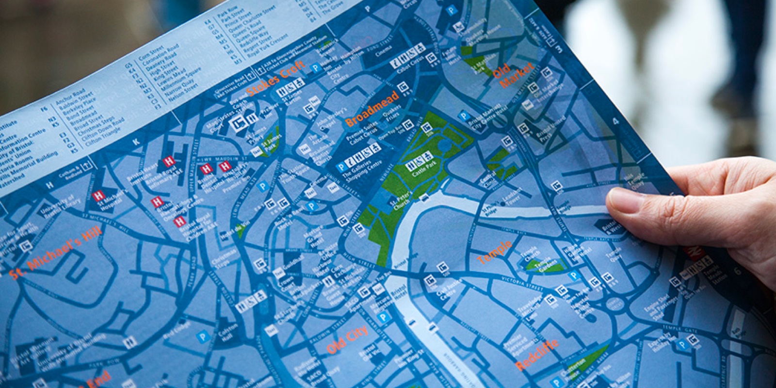
The system includes direction signs, on-street information panels with city and area maps, printed walking maps, visitor information identity and arts projects. It’s now a foundational part of the city’s welcome and the scheme has been replicated around the World. But Bristol’s hardware has barely been touched for nearly two decades and the scheme needs an upgrade.
Mixed-methods research
Bristol City Council asked us to uncover exactly what people needed from the scheme so they would know where effective investment should be made to improve city navigation.
In addition to reviewing the scheme’s existing maps and signage, the Council asked us to consider people's end-to-end experience of navigating Bristol, from multiple perspectives. Using a mixed-methods approach, including observational research, depth interviews and surveys with visitors, locals, business owners and the organisations set up to represent them, we set out to understand that experience.
People rely on the scheme
Despite the prevalence of smart phones, we found that visitors relied heavily on the on-street wayfinding system. Many used Google Maps, but they tended to have a much harder time trying to find their way around. For example, Google Maps doesn’t necessarily recommend the most scenic route or how to cross as few four-lane roads as possible.
The surveys provided the numbers to support those observations. More than half of the visitors surveyed had used the Legible City system to find their way through the city, and 97% of those had found it helpful. Nearly a quarter of Bristol’s visitors completely rely on the signs and maps.
Gaps and opportunities
We also uncovered a significant number of unmet needs:
- While visitors can easily find their way to areas which have been recommended to them, they have no way of knowing where to go next
- Business owners want their neighbourhoods to have stronger identities
- Locals and business owners want the city to take a stronger role in transforming public spaces into welcoming, bustling thoroughfares
- Business organisations wanted better linkages between the beating hearts of the city
A vision for the scheme
Nat Roberton, Bristol Legible City Project Manager, said:
“All of this falls solidly into Legible City’s remit and is a far cry from the concerns at the beginning of the project. The team started with the possibility that the scheme had outlived its usefulness and ended with a vision for Bristol’s Legible City scheme that will return it to its visionary origins.”
Next steps
The outline plan for the future of the project will be to support the local economy through encouraging visitors and residents to explore and rediscover Bristol’s cultural heritage and retail offering. Bristol City Council will be doing this by upgrading the on-street signs to feature illuminated, updated mapping highlighting what the city has to offer.
The Council will also be developing digital mapping products that will allow users to get a live view of what’s going on in Bristol, and how to access the city’s events and destinations via their phones/devices.
In addition, the popular, free paper map of the city will be re-designed and re-issued to help people find their way around by foot and bike.
Evidence not guesswork
Crafting a public space and wayfinding system for Bristol that meets all of those needs is an ongoing journey, but the Legible City team now has a solid, evidence-based foundation for the recommendations it puts forward and decisions it needs to make.


Problems Worth Solving

Contact us

